Camp Strake Orienteering Course
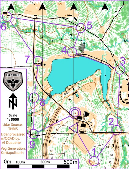
 There is a permanent orienteering course established at Camp Strake. A copy of the map and clue sheet along with a compass should be provided to each buddy team that runs the course. This is a challenging course for beginning participants, but it does meet the layout requirements for the First Class rank orienteering requirement. Before going on the course, participants should be familiar with map reading techniques and compass use. Orienteering is a competition event. Units using the course should encourage Scouts to move as quickly as possible without missing any of the control points. There are numerous places along the course where the heights or widths of objects can be measured. It is not possible to travel in straight lines on this course. Participants will have to use their land navigation skills to maneuver around obstacles. An experienced team can complete the course in about an hour. Most teams will require at least two hours to do the course. For additional information or assistance, contact David Van Kleeck at david.vankleeck@entouch.net.
Orienteering Basics: The sport of orienteering began in the late 19th century in Scandinavia. In its classic form, orienteers (competitors) are given a topographic map with a series of controls marked on it. They find these controls in order and return to the starting point; the orienteer with the best time wins.
Scope: Following are instructions for the orienteering courses currently established at Camp Strake. Operation of these courses supports the conduct of the Orienteering Merit Badge and rank advancement requirements. From time to time, it may also support troop program activities as well as council-supported orienteering events.
Policies: Orienteering is normally an individual competitive event. It is essentially a cross-country race using a map and compass to find specified waypoints. However, in order to comply with BSA safety requirements, any orienteering activity at Camp Strake must use the buddy system. Participants will be advised not to cross any fences on the camp property. The northern boundary of the orienteering courses is the range road. There are no orienteering control points located north of this road.
Procedures: The present full course is over a mile in length (straight-line distances) and thus meets the First Class rank orienteering requirement. Clearly, it is not possible to travel in straight lines between points because of the terrain and vegetation. That will challenge even the more experienced orienteering participants. The objective of the course is to use the orienteering map provided to find and identify correctly all of the control points in the order laid out for the course. The following table contains the key for the order of the points in the course.
Sequence
|
Latitude
|
Longitude
|
Comments
|
| Start |
30.617822 N |
95.254781 W |
STEM Building |
| 1 |
30.615464 N |
95.253134 W |
Future Chapel Site |
| 2 |
30.617731 N |
95.251278 W |
North of Campsite #1 |
| 3 |
30.622100 N |
95.251081 W |
Trail NW of Training Ctr |
| 4 |
30.623303 N |
95.255112 W |
West of Lake Spillway |
| 5 |
30.625055 N |
95.254448 W |
Road from Archery to Lake |
| 6 |
30.625747 N |
95.260593 W |
South of ATV building |
| 7 |
30.622606 N |
95.257953 W |
NW of climbing tower |
| 8 |
30.619964 N |
95.257466 W |
West side of silt pond |
| 9 |
30.617326 N |
95.258206 W |
Road west of Campsite #17 |
| Finish |
30.618887 N |
95.254777 W |
West of Grand Pavilion |
The overall layout of the points is shown in the picture below. This is provided primarily for use by the leaders supervising the orienteering activity. It can be used in debriefs following the activity to help participants find any points they had difficulty with during the course. Yellow points are orienteering course control points.
Participants should know their pace counts. A football field makes a good known distance. There is a known distance marked on the Camp Strake activity field near the course start point. Most Scouts have a count between 110 and 120 paces per 100 yards. The participants should use the orienteering map along with a compass to find the control points in order.
Distances can be estimated using the scale on the map.
- When the participants reach control points, they should record the point name in the table on the back of the orienteering map sheet in the box corresponding to the control point number. Or use the hole punch at the control point to punch a pin pattern on their course card. Those in charge of running the course can check the completeness and accuracy of the card once participants complete the course.
- To run an event, provide buddy pairs (never do Scout events solo) with a map and compass. Sequence buddy pairs so that they start every 30-60 seconds apart. Record their start time.
- Orienteering is a timed event; thus, the winner is the buddy team with the fastest time while also getting all of the control point names correct.
- Cards with incorrect names or hole punches will result in the buddy pair being disqualified for competition purposes. Being disqualified does not prevent Scouts from meeting the rank advancement requirement nor any of the applicable Orienteering Merit Badge requirements.
- Organizers should recognize the top finishers.
Geocaching
Geocaching is a sport that combines land navigation using maps and GPS receivers with problem-solving and competition. In geocaching, participants navigate to a specific set of GPS coordinates and then attempt to find the geocache (container) hidden at that location. A typical cache is a small waterproof container containing a logbook where the geocacher enters the date they found it and signs it with their established code name. Often, there are tiny trade items you can take away as souvenirs.
Geocaching is often described as a “game of high-tech hide and seek.” It’s a fun way to spend a day or a weekend and to practice important Scouting skills.
Scope: Following are instructions for the geocaching course currently established at Camp Strake. Operation of this course supports the conduct of the Geocaching Merit Badge and rank advancement requirements (use of a GPS). From time to time, it may also support troop program activities as well as council-supported events.
Policies: Geocaching is normally an individual activity. It is essentially a cross-country treasure hunt find specified caches. However, in order to comply with BSA safety requirements, any geocaching activity at Camp Strake must use the buddy system. Participants will be advised not to cross any fences on the camp property. The northern boundary of the orienteering courses is the range road. There are no geocaches located north of this road.
Procedures: The present set of geocaches comprises a course is over a mile in length (straight-line distances) if the participant chooses to find the caches in the order listed. Clearly, it is not possible to travel in straight lines between points because of the terrain and vegetation. The objective of the course is to use a GPS receiver (handheld receiver or cell phone app) along with a map to find the caches. Caches may be located in the order listed, or individually depending on the time available. If you choose to use the caches as a course, you will find clues to find the next cache in the sequence in the current cache. So, it is possible to complete the course by providing only the location of the first cache in the sequence.
Cache #
|
Latitude
|
Longitude
|
Cache Name
|
Location
|
| 1 |
30.617609 N |
95.253761 W |
Science Guy |
STEM Building |
| 2 |
30.615467 N |
95.253695 W |
Reverence and Reflection |
Future Chapel |
| 3 |
30.617187 N |
95.247325 W |
Welcome Mat |
Entrance Building |
| 4 |
30.619995 N |
95.251963 W |
Sunshine Bridge |
Bridge west of Training Building |
| 5 |
30.621333 N |
95.253581 W |
Showtime |
Arena |
| 6 |
30.622512 N |
95.251482 W |
Little Dutch Boy |
Dam |
| 7 |
30.625229 N |
95.254942 W |
William Tell |
Archery Range |
| 8 |
30.622671 N |
95.257429 W |
Stairway to Heaven |
Climbing Tower |
| 9 |
30.621508 N |
95.263697 W |
The Heights |
Mt. Franklin |
| 10 |
30.620071 N |
95.255895 W |
Pirates Cove |
Boathouse |
Geocaching Resources:
Disc Golf
Disc golf is a flying disc sport in which players throw a disc at a target; it is played using rules similar to golf. There is a 9-hole course at Camp Strake. Players complete a hole by throwing a disc from a tee pad or area toward a target, known as a basket, throwing again from where the previous throw landed until the basket is reached. The number of throws a player uses to reach each basket is tallied; players seek to complete each hole in the lowest number of total throws.
Disk Golf Resources:
Gaga Ball
There are two Gaga ball pits at Camp Strake. One is located behind the Grand Pavillion and one is in the sports field. Scouts must be monitored and supervised at all times. Gaga ball is a fast-paced, high-energy game that is a kinder, gentler version of dodgeball in an octagonal pit. Players begin with one hand on any side of the wall of the pit. A ball is tossed into the pit, and players yell “GA,” “GA,” and “BALL!” to mark each time the ball bounces in the pit. On the third bounce (“BALL!”), gameplay begins. Players can hit the ball with an open or closed hand but must leave the pit if they are hit by the ball anywhere below the waist. The ball cannot be held but can be caught on a flyball to get the previous “hitter” out. The last player standing wins the round. Games typically last a few minutes and can be intensified by the addition of a second ball. Leaders need to supply a dodgeball.
Fishing
Catch and release fishing is allowed at camp to catch bass, sunfish, bluegill and catfish. Bring your own poles and equipment. Hooks must be barbless. Suggested bait include worms, corn, jigs, spinnerbaits, crankbaits, and topwater lures. Fishing licenses are not required.
Nature Trails
Camp Strake Nature Guide

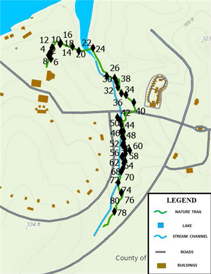
 The Camp Strake Nature Guide gives brief descriptions of some of the numerous varieties of trees and other plants found along the nature trail. Scouts in troops can work on First Class #5 (Identify or show evidence of at least 10 kinds of native plants in your community) and various merit badges.
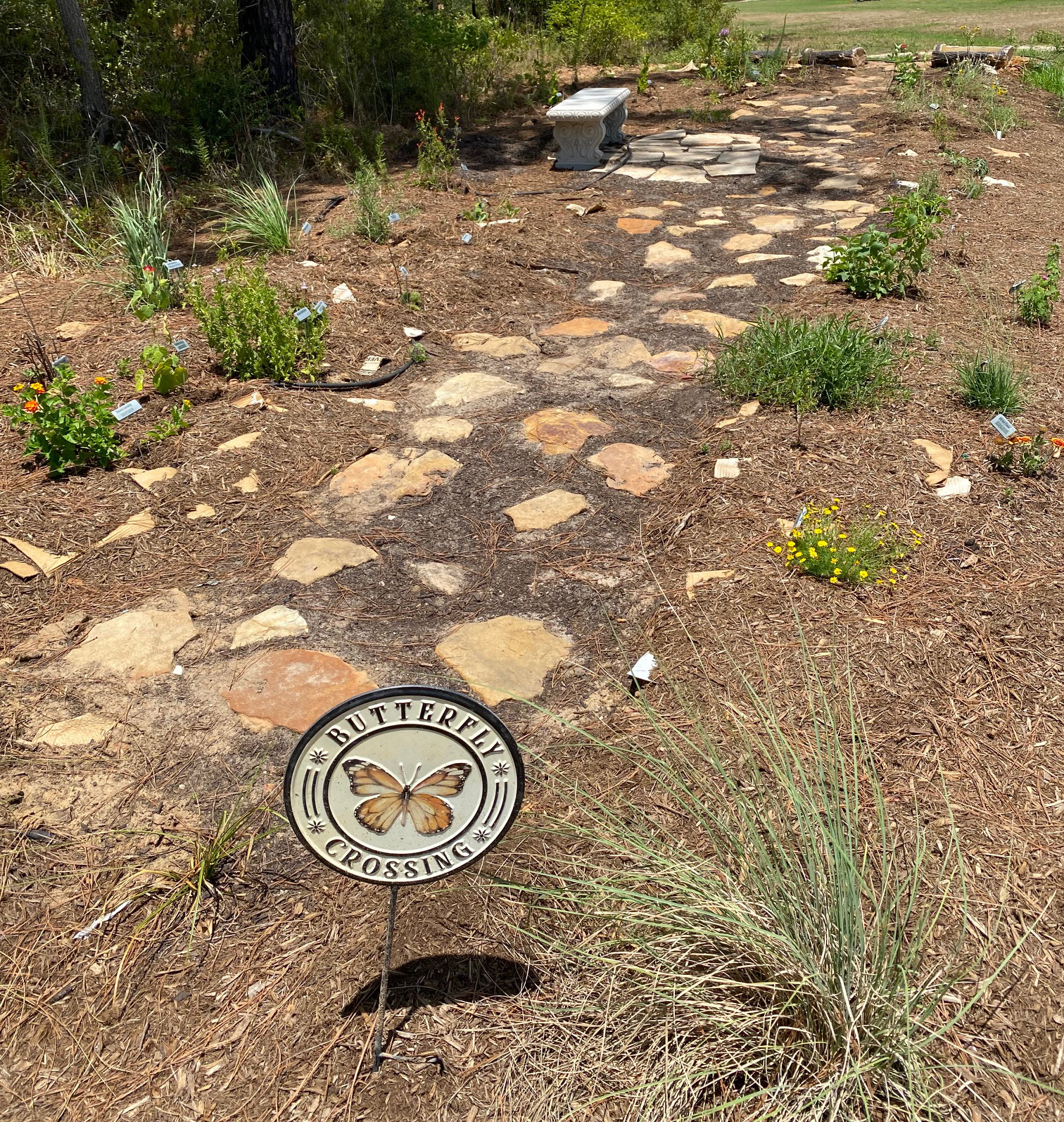
There are three native pollinator gardens at camp. The sunny garden is next to the tree line west of the STEM center, the shady garden is located west of the STEM center on the path between the trees, and the boggy garden is located on the west side of the HQ building.
Camp Strake Nature Guide Camp Strake Pollinator Gardens
iNaturalist
 iNaturalist is a free app to help identify plants and animals. Get connected with a community of over a million scientists and naturalists who can help you learn more about nature! What’s more, by recording and sharing your observations, you’ll create research-quality data for scientists working to better understand and protect nature. Download the app on your phone or visit iNaturalist.org.
Upload pictures to identify plants and wildlife. Tag Camp Strake.